|
BAVIAANSKLOOF WORLD HERITAGE SITE
(Most of the information on this page was supplied by Steve and Carole Eilertsen)
The Baviaanskloof is nestled between the Baviaans Mountain range in the north
and the Kouga Mountain Range in the south.
This 192 000 ha conservation area, recently awarded World Heritage Site status,
is home to an amazing diversity of habitat types and species. From Forest
yellowoods to karoo bossies, thicket spekboom to fynbos proteas, the Kloof is a
nature lover's paradise.
Baviaanskloof is arguably the most beautiful wilderness drive accessible
to 2x4 vehicles, enduro and off road motorcycles in South Africa.
The valley is 80km north west of
Port Elizabeth. There is a single dirt road that runs through the valley
with no other access either in or out. There are 42 river crossings yet not a
single bridge, only causeways. There are two river crossings that have neither a
bridge nor a causeway. All of them can flood during a heavy downpour.
Baviaanskloof is bordered by the town of Patensie in the East and Willowmore /
Uniondale in the West. The distance from town to town is just over 200km -
only 30km of which is tar. The rest is dirt road that varies from excellent to
very bad. During the winter the valley is extremely cold and during the height
of summer, extremely hot. All terrain vehicles with 2x4 transmission can easily
manage during the dry season while 4x4 is recommended during wet weather (i.e.
November to February).The valley is divided broadly into three regions i.e. before the wilderness
area, the wilderness area itself and the area beyond the wilderness. The eastern
and western regions are characterised by a small number of farms that offer
accommodation and other activities like 4x4 trails etc. The dirt road here is
good. The wilderness area offers only camping at designated areas, by permit
only. The dirt road here is average to very bad.
The Wilderness Area
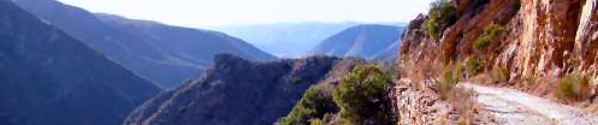
The first section of the Baviaanskloof Wilderness area is characterised by a
steep climb from the indigenous forest below to the open grasslands at the
summit. This area is breathtaking wilderness at its best. Going uphill is always
easier on a motorcycle and therefore confident, inexperienced riders can manage
this section if road surface is dry. Note the absence of guard rails.
The summit features open grasslands with magnificent views. Antelope and fynbos
abound.
The descent back into the valley is technically the most difficult. Very steep
and rocky - not for inexperienced riders
One may drive through this area without a permit. To deviate from the road for
any reason including camping, hiking etc requires a permit from Tolkos in
Patensie or the Baviaanskloof office at Komdomo. Note that there is no mobile
phone reception in this area. Only limited numbers of campers may be in this
area at any one time. Therefore if you would like to travel there during holiday
season booking is essential i.e. (042 283 0437 or http://www.baviaans.net )
Normal wilderness rules apply. There are no ablution facilities along the road.
Take your own toilet paper and a few spare plastic bags. Soiled paper, nappies,
sanitary towels etc must be removed from the area.
The valley can be only traversed from East to West or West to East. The eastern
section is technically the most difficult with the western section being very
easy and suitable for everyone
Spring, before the heavy summer rains or Autumn before it gets cold, are the
best times to visit if you intend to camp. If you stay at a lodge or B+B outside
the wilderness area and own a good all terrain vehicle then you have more
flexibility weather wise.
The most difficult dry section is between Bergplaas and Doodsklip (24km from the
Komdomo Baviaanskloof office) This is a steep, rocky downhill section more than
one kilometer in length with a very steep drop on the valley side.
This is an unforgiving route, especially if ridden under tight time constraints.
It is not possible to ride from East to West and back by the same route, on the
same day. In this case the main road, the N2 should be used to return (a 10 hour
round trip). Alternatively you can stay over at a B+B on the other side.
Start before 8am in the morning. In the east it is normal to only complete 20km
in 2 hours. The time lost here can be made up on the west where speeds of 80kph
are possible for short distances. If the weather is good, the valley takes 6
hours to travel through but note that this excludes picnics and other stops.
Game
The area has abundant game but is not big 5 country. Antelopes, tortoises and
snakes are common. Baboons, from where the valley got its name, will be sighted
many times during the day.
Smitskraal in Baviaanskloof marks the longest river crossing . . .
The final section of Baviaanskloof is easy. B+B accommodation at the farms along
the road is plentiful. The Nuwekloof Pass at the end, offers a spectacular
finale to this dramatic tour.
Please check out our Photo gallery section for some
magnificent photos of Baviaanskloof, taken by
Steve and Carole Eilertsen
Contact us for more info
|
|